


POINT CLOUD PROCESSING
East Anglia · Hertfordshire · Essex · London · South East
Constructionline Gold | SSIP Accredited | Achilles | 17 PAYE Engineers
Registered, cleaned and georeferenced point cloud data — ready for CAD, BIM or your own in-house processing
CALL US ON: 01279 927 033
WHAT IS POINT CLOUD PROCESSING?
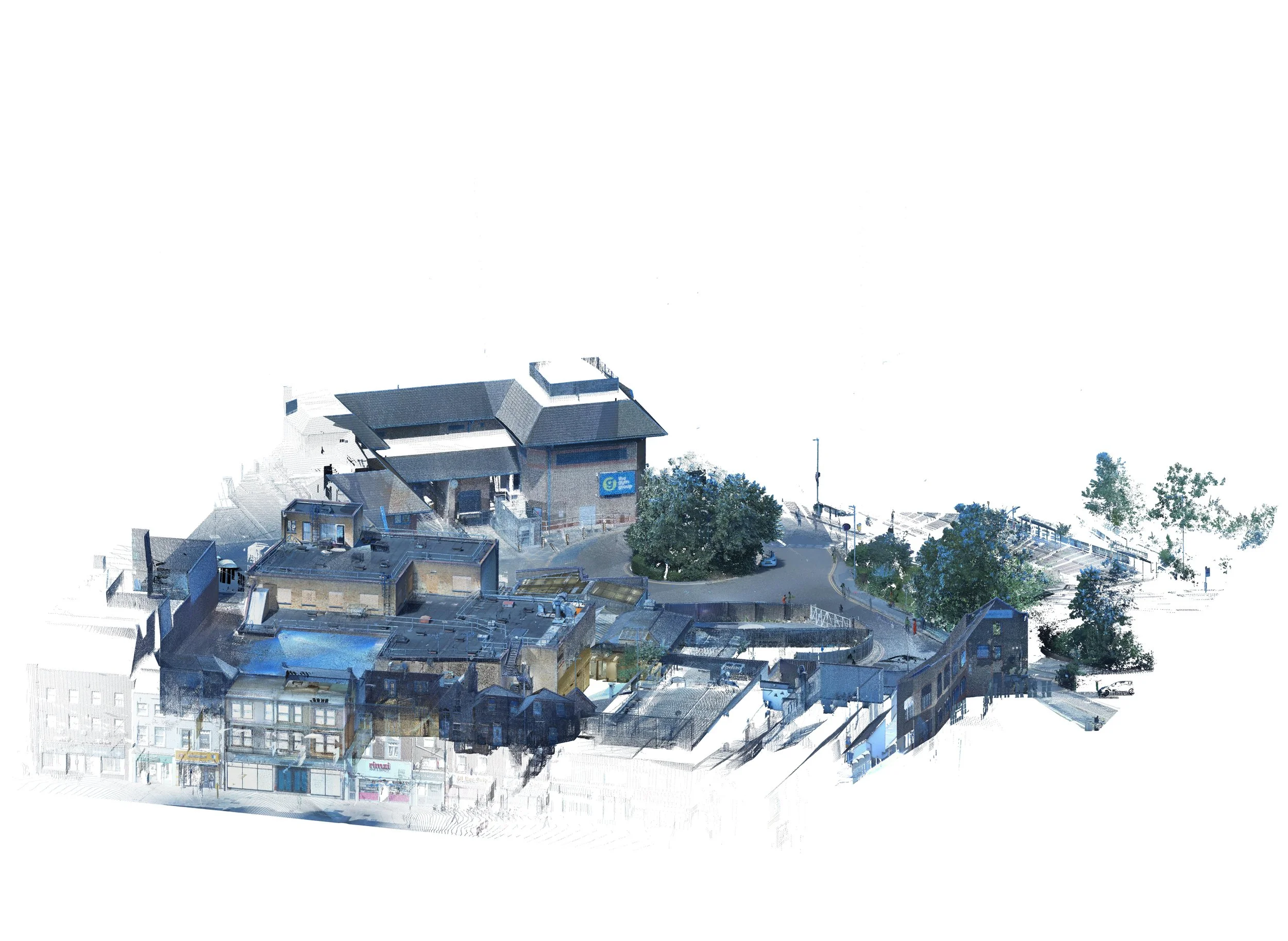
Point cloud processing is the step between capturing a laser scan and producing a usable deliverable. Raw scan data from each scan position is registered into a single, unified dataset, cleaned of noise and unwanted objects such as people, vehicles and vegetation, georeferenced to the site control network or OS National Grid, and exported in the format your team needs.
AKN processes point cloud data captured on our own Trimble X9 scans as standard, and can also process point cloud data captured by other surveyors or scanners where a client needs an independent processing service.
Want to discuss a project? Call us on 01279 92703
WHEN IS POINT CLOUD PROCESSING USED?
☁️ As the standard first step on every AKN 3D scanning project, before CAD, Revit or ArchiCAD deliverables are produced
☁️ Where a client has already commissioned scanning (their own equipment or another provider) and needs the raw data registered and cleaned
☁️ Where a lightweight, decimated point cloud is needed for a design team's software or hardware to handle efficiently
☁️ Where data needs to be re-georeferenced to a different coordinate system or tied into a new site control network
Want to discuss a project? Call us on 01279 927033
DELIVERABLES FROM POINT CLOUD PROCESSING
✅ Registered, cleaned point cloud (.E57, .RCP/.RCS, .LAS/.LAZ)
✅ Decimated / lightweight versions for design software that can't handle full-density data
✅ Colourised and/or classified point cloud data
✅ Coordinate transformation and georeferencing to OS National Grid or project control
✅ QA report confirming registration accuracy
Find out more about how we work… Call us on 01279 927033
HOW WE PROCESS YOUR POINT CLOUD
Raw scan data imported from site (ours or supplied by the client)
Scan positions registered together in Trimble RealWorks
Noise, vegetation and moving objects cleaned from the dataset
Data georeferenced to the required coordinate system
Quality-checked and exported in the agreed format
TRUSTED BY














WHY CHOOSE AKN ENGINEERING FOR YOUR POINT CLOUD PROCESSING?
✔️ Same Trimble RealWorks workflow used across every AKN scanning project — consistent, defensible results
-✔️ Can process data from any Trimble X9-equivalent scanner, not just our own captures
✔️ Fast turnaround — processing is usually the shortest part of the programme
✔️ Constructionline Gold, SSIP and Achilles accredited
FAQs
-
Yes. We regularly process and clean up point cloud data captured by other surveyors, provided the raw scan files are supplied in a compatible format.
-
Raw data is the unregistered output straight from the scanner at each position. Processed data has been registered into a single dataset, cleaned, georeferenced and exported — it's what design teams and other software actually work with.
-
E57, RCP/RCS and LAS/LAZ as standard. Let us know your software and we'll match the format to it.
-
Typically 3-5 working days after the site visit, depending on the size of the dataset and the deliverable required.

LOCATIONS WE COVER
HERTFORDSHIRE
BEDFORDSHIRE
CAMBRIDGESHIRE
NORTHAMPTONSHIRE
LONDON
ESSEX
KENT
OXFORDSHIRE
BERKSHIRE
NORFOLK
SUFFOLK
LINCOLNSHIRE
RUTLAND
AKN Engineering is based in Bishop's Stortford, CM23, and covers the following regions as standard. Projects outside these areas considered — please call to discuss.





Request a Quote
Fill out the form below, and you can expect to hear from us within 24 hours.
(If you do not receive a response within 24 hours (Mon-Fri) please email office@aknengineering.co.uk)
BOOK YOUR POINT CLOUD PROCESSING TODAY
Call us on
01279 927033
OUR SERVICES
SETTING OUT SURVEYS
MEASURED BUILDING SURVEYS
AS-BUILT SURVEYS
TOPOGRAPHICAL SURVEYS
SITE ENGINEERING
PILING SETTING OUT
DESKTOP UTILITY SEARCH
VOLUME ANALYSIS
PLANNING DRAWINGS
UNDERGROUND UTILITY SURVEYS
3D LASER SCANNING SURVEY
IFC MODELS
GPR SURVEYS
DRONE SURVEYS
POINT CLOUD PROCESSING
SCAN TO BIM
CAD TO BIM
REVIT MODELLING
MATTERPORT WALKTHROUGHS

POINT CLOUD PROCESSING — REGISTERED, CLEANED & GEOREFERENCED DATA
AKN Engineering provides point cloud processing for architects, engineers and design teams across Hertfordshire, Essex, London, the South East and East Anglia.
Using the Trimble X9 3D scanner and Trimble RealWorks, we register, clean and georeference point cloud data and deliver it in E57, RCP or LAS format, ready to use immediately.
Constructionline Gold · SSIP Accredited · Achilles · Fully insured · All engineers PAYE
Also see: 3D Scanning Surveys · Scan to BIM · Revit Modelling