
GPR SURVEYS
(GROUND PENETRATING RADAR SURVEYS)
CALL US: 01279 927 033
FOR DETAILED UNDERGROUND DETECTION WHERE TRADITIONAL METHODS STOP SHORT
When conventional detection methods aren’t enough — for non-metallic pipes, ducts, or complex substrates — our GPR Survey service steps in.
At AKN Engineering, we deliver advanced ground-penetrating radar (GPR) surveys to detect, image, and map subsurface features with exceptional clarity — giving you confidence where others can’t.
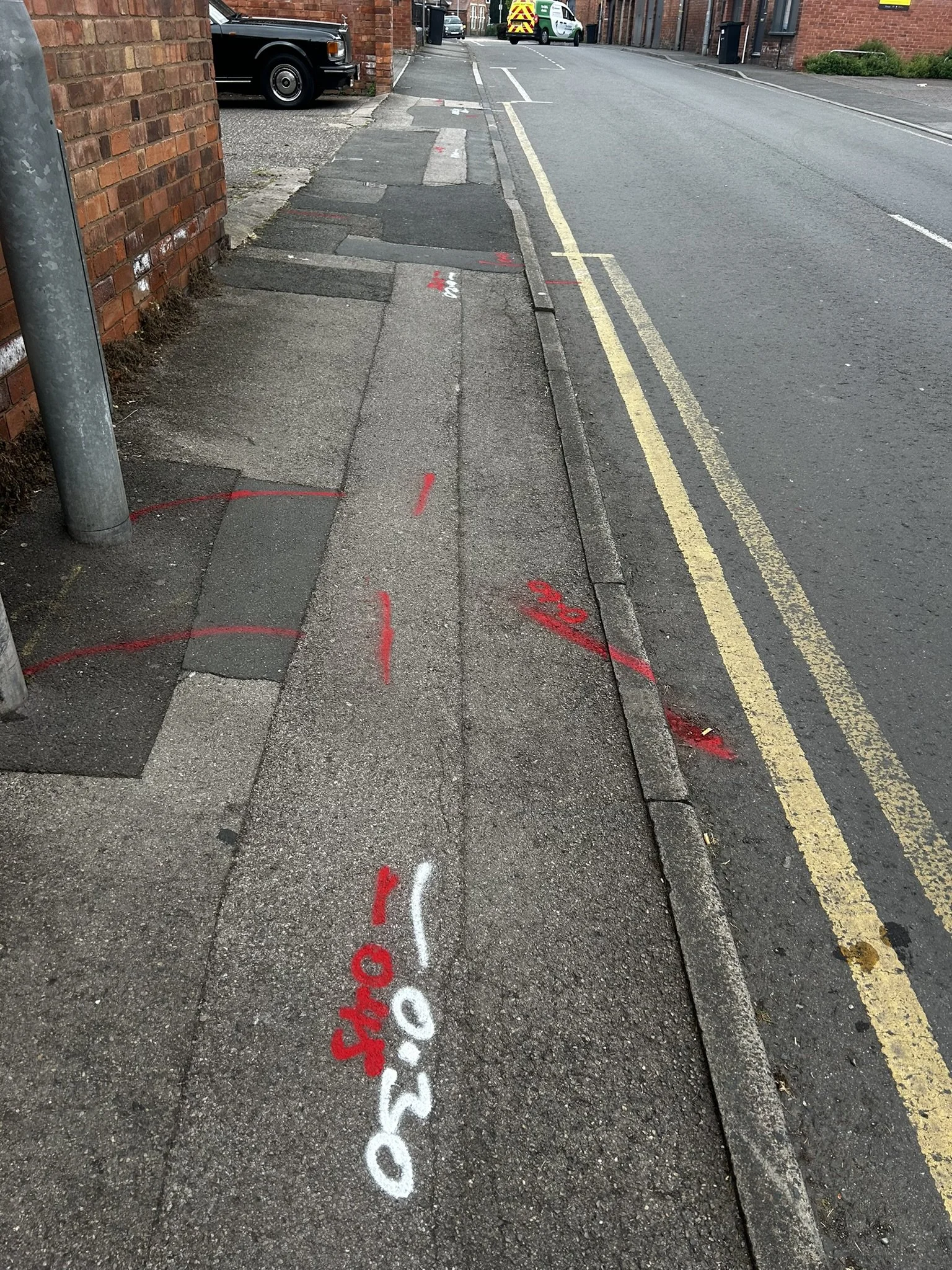
A GPR survey (Ground-Penetrating Radar Survey) is a non-invasive detection technique used to locate buried utilities and structures by transmitting high-frequency radar pulses into the ground. These pulses reflect off changes in material density — such as pipes, ducts, voids, or foundations — allowing our engineers to interpret subsurface conditions accurately.
GPR is ideal for:
Plastic or concrete pipes not detectable by electromagnetic methods
Utility mapping in congested urban areas
Geotechnical and archaeological investigations
Pre-construction risk assessments
Learn more about the complementary Underground Utilities Surveysand how GPR integrates with our EML (Electromagnetic Locator) services for full PAS 128 Type B utility mapping.
WHAT IS A GPR SURVEY?
Want to discuss a project? Call us on 01279 927033
WHY USE GPR?
Ground Penetrating Radar provides unparalleled visibility of non-metallic or unrecorded underground services, including:
Plastic water mains
Clay or asbestos drainage runs
Buried utility ducts and voids
Buried chambers and structures
It penetrates concrete slabs, pavements, and compacted soils with precision, producing high-resolution subsurface images for engineers, architects, and designers.
This makes GPR essential for:
Pre-excavation planning
Risk reduction under CDM Regulations 2015 (HSE.gov.uk)
Design validation and site safety compliance
Want to discuss a project? Call us on 01279 927033
WHAT WE DELIVER
Our deliverables are fully CAD-integrated and formatted for your project environment.
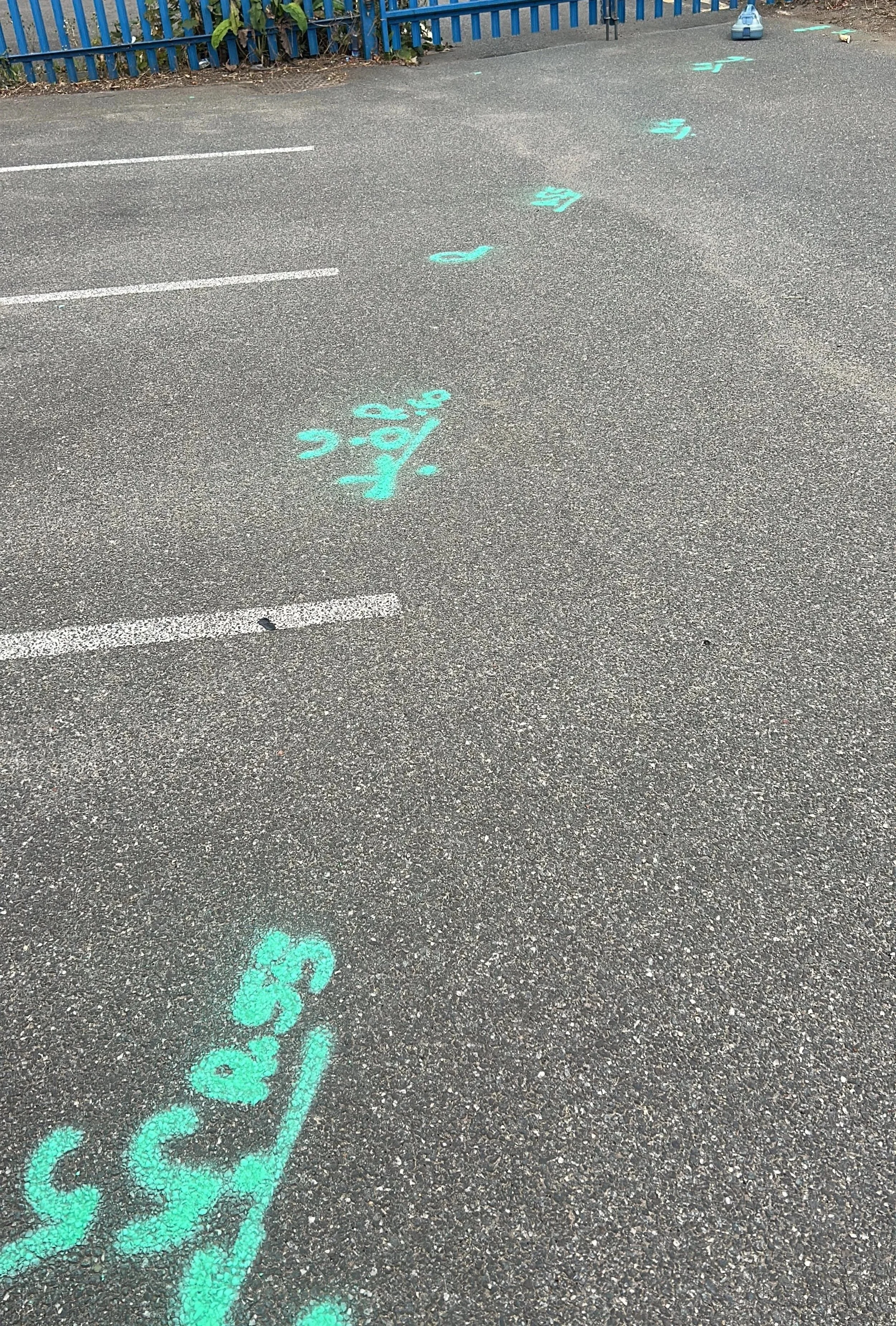
Radar cross-sections, depth slices, and 3D radar volumes
✅ Annotated utility maps aligned with your topographical survey
✅ Interpretation reports including confidence levels and recommendations
✅ Depth estimations and anomaly highlights
✅ Colour-coded CAD layers (DWG, DXF, PDF) compatible with your design files
✅ Site notes and photos (if required)
Find out more about how we work… Call us on 01279 927033
TRUSTED BY


OUR APPROACH AND TECHNOLOGY
We tailor every GPR investigation to your site and project requirements.
1️⃣ Site Scoping & Calibration
We assess soil type, dielectric constant, and moisture content to set up the optimum radar configuration.
2️⃣ GPR Data Acquisition
Using multi-frequency antenna systems, we scan across structured grid patterns to capture consistent, repeatable data.
3️⃣ Post-Processing & Interpretation
We apply advanced signal filtering and migration techniques to enhance clarity and extract usable depth data.
4️⃣ Correlation & Validation
Radar anomalies are correlated against known utilities or validated through targeted verification (spot excavations or EML).
5️⃣ Deliverables & Integration
Outputs are compiled into interpretative drawings and reports. We can overlay findings onto your Topographical Survey or Utilities Desktop Search data for a complete underground model.
A GPR utility survey is recommended when:
Your desktop utility search indicates unverified or incomplete data
You suspect non-metallic or unrecorded services
You’re working on highways, brownfield, or redevelopment sites
You need depth estimates or confirmation before excavation
You require PAS 128 Type B verification before design sign-off
Learn how a Utilities Desktop Search complements GPR surveys to form the first step in underground utility detection.
WHEN TO CHOOSE A GPR SURVEY
✔️ PAS 128-compliant GPR and EML mapping
✔️ Fully CAD-integrated outputs with confidence-level annotation
✔️ Rapid mobilisation and flexible scheduling
✔️ Experienced, GPR-trained surveyors using Leica DS2000 and IDS Stream systems
✔️ One-stop service — from desktop searches to on-site detection and mapping
Our clients include main contractors, developers, architects, local authorities, and design consultants who rely on our surveys for safe excavation, accurate planning, and confident design decisions.
WHY CHOOSE AKN ENGINEERING
Want to discuss a project? Call us on 01279 927033
FAQs
-
A GPR Survey (Ground Penetrating Radar Survey) uses radar pulses to detect and map underground utilities, voids, and structures.
It’s a non-intrusive method that can identify non-metallic services (like plastic water pipes or concrete ducts) that electromagnetic (EML) methods can’t detect.
It’s often used as part of a PAS 128 Type B Utility Survey to confirm the presence and depth of buried services. -
Although GPR is powerful, it has limitations:
Highly conductive or saturated clay soils reduce radar penetration
Metallic reinforcement in concrete can obscure deeper reflections
Deep utilities (typically >3m) may not be visible in all conditions
Our engineers assess soil type, ground conditions, and site layout before scanning to set realistic expectations.
If visibility is limited, we recommend combining GPR with Electromagnetic Location (EML) — see our Underground Utilities Surveys page for details.
-
Yes — if your site includes non-metallic services, complex ground conditions, or uncertain utility records, a GPR survey helps reduce the risk of utility strikes.
It’s a key component of PAS 128-compliant utility mapping, which supports compliance with HSG47 (“Avoiding Danger from Underground Services”) and CDM Regulations 2015 (HSE.gov.uk).If you’re still at the design or planning stage, start with a Utilities Desktop Search to gather statutory records before commissioning on-site surveys.
-
Accuracy depends on several factors:
Soil composition and moisture
Antenna frequency (typically 250 MHz – 800 MHz)
Ground surface conditions and survey grid density
Under PAS 128:2022, GPR surveys typically achieve Quality Levels QL-B1 to QL-B4, with depth estimates usually within ±10% of actual depth in favourable conditions.
-
Yes. GPR can penetrate reinforced concrete, asphalt, and paved surfaces, making it ideal for highways, car parks, and urban sites. It's commonly used for void detection and service location beneath hardstanding areas.
-
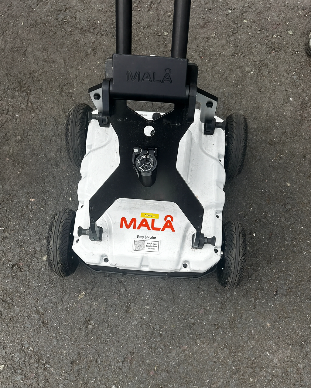
We use multi-frequency radar systems such as the Leica DS2000, IDS Stream, and MALÅ GPR units — depending on site conditions and project scope.
These deliver high-resolution data that can be processed into depth slices, cross-sections, and 3D radar volumes for clear visualisation. -
All AKN Engineering GPR Surveys are completed in accordance with:
PAS 128:2022 — Specification for Underground Utility Detection
HSG47 — Avoiding Danger from Underground Services (HSE.gov.uk)
CDM Regulations 2015 — Safe excavation and design practices
We also follow manufacturer calibration guidance and site-specific method statements.
-
You’ll receive:
CAD drawings (DWG, DXF, PDF) with annotated utilities and anomaly positions
Depth and confidence data
Interpretation report with findings and limitations
Supporting radar cross-sections and site photos (if required)
Outputs can be integrated directly with your Topographical Survey or Utility Record Plans.
-
Our GPR teams can usually mobilise within 3–5 working days, depending on project location and access requirements.
If you already have a desktop search or site plan, we can quote and schedule even faster. -
Pricing depends on:
Site area and access conditions
Complexity of the underground environment
Whether combined with EML detection or topographical surveying
We offer transparent, fixed-cost quotes for each project. Contact us on 01279 927 033 or request a quote online for a tailored estimate.
-
Yes — GPR is most effective when used alongside:
Electromagnetic Location (EML) for metallic utilities
Topographical Surveys for accurate surface context
Utilities Desktop Searches for statutory record verification
We offer complete utility mapping packages, combining all three for end-to-end PAS 128 compliance.
-
Yes. Our post-processing workflow can generate 3D radar volumes and subsurface models, ideal for complex sites and BIM integration.
These outputs can be exported in standard formats for use in AutoCAD Civil 3D or Revit environments.

LOCATIONS WE COVER
HERTFORDSHIRE
BEDFORDSHIRE
CAMBRIDGESHIRE
NORTHAMPTONSHIRE
LONDON
ESSEX
KENT
OXFORDSHIRE
BERKSHIRE
NORFOLK
SUFFOLK
LINCOLNSHIRE
RUTLAND
OUR SERVICES
SETTING OUT SURVEYS
MEASURED BUILDING SURVEYS
AS-BUILT SURVEYS
TOPOGRAPHICAL SURVEYS
SITE ENGINEERING
PILING SETTING OUT
DESKTOP UTILITY SEARCH
VOLUME ANALYSIS
UNDERGROUND UTILITY SURVEYS
3D LASER SCANNING SURVEY
GPR SURVEYS
DRONE SURVEYS
Request a Quote
Ready to request a quote for your GPR Survey?
Fill out the form below, and you can expect to hear from us within 24 hours.
(If you do not receive a response within 24 hours (Mon-Fri) please email office@aknengineering.co.uk)


Book Your GPR Survey Today
Prefer to speak? Call us on
01279 927033
OUR SERVICES
SITE ENGINEERING
Site engineering services play a critical role in the construction process, providing expertise and support to ensure the successful execution of a project. These services encompass a wide range of activities, including site investigation, surveying, and topographical mapping. Site engineers work closely with the design team and construction crew to establish the necessary groundwork, determine the optimal layout, and oversee the implementation of plans on-site.
TOPOGRAPHICAL SURVEYS
Topographical surveys are detailed assessments of the natural and man-made features on a specific piece of land. These surveys provide crucial information about the elevation, contours, and physical characteristics of the site, including buildings, trees, bodies of water, and other relevant elements. By conducting topographical surveys, engineers and planners can gain a comprehensive understanding of the terrain, which is essential for making informed decisions during the design and construction phases of a project.
SETTING OUT
Setting out is a vital process in construction that involves marking the precise locations and dimensions of structures, roads, or other elements on a construction site. It ensures that the project is executed accurately and in accordance with the design plans. Surveyors and engineers use various tools and techniques to establish reference points, levels, and alignments, allowing construction teams to follow precise measurements and positioning during the building phase.
AS-BUILT SURVEYS
As-built surveys are conducted typically at the completion of a construction project to document the actual constructed conditions of the site and its improvements. These surveys serve as a comparison to the original design plans and specifications provided by the engineer during the planning phase. By conducting as-built surveys, engineers can ensure that the constructed elements align with the approved design and meet all required standards and regulations.
MACHINE CONTROL
Machine control for earth moving involves the creation of precise digital models and plans, which are then translated into real-time instructions for construction equipment. Through the integration of advanced technologies such as GPS, sensors, and software interfaces, these machines are guided to execute excavation and grading tasks with exceptional accuracy and efficiency, resulting in reduced material waste, optimised project timelines, and enhanced overall productivity in earth-moving operations.
The main goal of volume calculation is to find out a volume of material that was mined or heaped up in predefined area and to verify if the volume corresponds to the expected value stated in project documentation. The volume is determined by a difference of topographies from two survey phases or by a difference between the survey and the project documentation.
VOLUME ANALYSIS
PILING SETTING OUT
Piling setting out ensures each pile is positioned accurately before installation. Our engineers use high-precision instruments to mark out locations, levels and spacing so your foundation works start right first time
DESKTOP UTILITY SEARCHES
Desktop utility searches gather and review plans from all network providers. We compile and verify this information into a clear, combined drawing to support early design decisions and reduce excavation risks.
UNDERGROUND UTILITIES SURVEYS (PAS 128)
Our PAS 128 utility surveys give a clear, reliable picture of buried services. Using EML, GPR and utility records, we identify the route, depth and type of underground assets to support safe and informed construction planning.
GPR SURVEYS
Ground Penetrating Radar helps detect non-metallic and deep-buried services where EML is limited. Ideal for complex or sensitive sites, GPR offers a safe, non-intrusive way to understand what lies beneath the surface.

GPR SURVEYS — POSITIONAL DETECTION & MAPPING
AKN Engineering provides ground penetrating radar (GPR) surveys for the detection and positional mapping of buried utilities and subsurface features across Hertfordshire, Essex, London, the South East and East Anglia. Used alongside electromagnetic location, GPR detects and positions buried services and records their depth and alignment, tied into your site control and supplied on CAD to PAS 128.
Constructionline Gold · SSIP Accredited · Achilles · Fully insured · All engineers PAYE
Also see: Underground Utility Surveys · Desktop Utility Searches · Topographical Surveys