


DESKTOP UTILITY SEARCHES
CALL US: 01279 927 033
EARLY STAGE DESIGNING OR PLANNING?
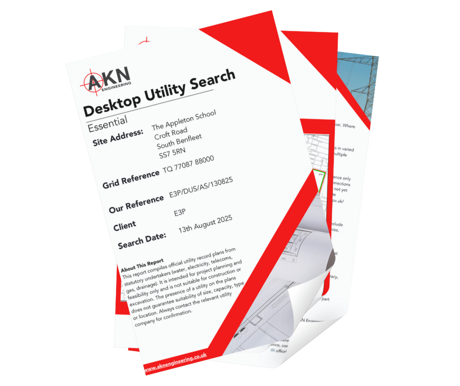
Our Utility Searches service gives you access to statutory utility data, records, and site intelligence without in situ detection. It’s an essential first step to inform your surveys or design baseline.
Also known as a "Utility Records Search" or "Statutory Asset Search," this service involves collecting published and proprietary utility data from service providers, infrastructure owners, and public records. You receive a compilation of existing plans and data for known underground services within your area of interest.
Understanding what lies beneath your site is essential for project success and legal compliance. Striking an underground utility can result in project delays of several weeks, repair costs exceeding £50,000, potential injury, and prosecution under the Health and Safety at Work Act 1974. Our utility searches provide critical baseline information that informs safe excavation planning, accurate cost estimation, and effective design development.
The process typically takes 5-10 working days once all utility providers have responded. Under CDM Regulations 2015, clients and principal contractors have a legal duty to identify underground services before any excavation work commences, making utility searches a regulatory requirement, not an optional extra.
WHAT IS A UTILITIES SEARCH?
Want to discuss a project? Call us on 01279 927033
A utilities search should be one of your first considerations when planning any ground-related works:
Pre-Planning Applications — Identify potential utility conflicts before submitting planning applications to avoid costly design revisions.
Before Topographical Surveys — Inform your surveying team of known underground services so they can take appropriate precautions.
Prior to Ground Investigation Works — Essential before trial pitting, borehole drilling, or any intrusive ground investigation.
During Feasibility Studies — Assess whether existing utilities will constrain your development and inform preliminary cost estimates.
Before Excavation or Piling Works — Mandatory safety measure before breaking ground to protect workers and avoid service strikes.
For Basement Conversions or Extensions — Identify services that may need diversion or protection, particularly in urban areas..
WHEN DO YOU NEED A UTILITY SEARCH?
Want to discuss a project? Call us on 01279 927033
WHAT WE DELIVER
A comprehensive utility search provides everything needed to understand the recorded underground infrastructure within your site boundary, including:
Complete Utility Asset Plans — Digital copies of all plans and records received from gas, water, electricity, telecommunications, sewage, and other infrastructure providers.
Data Quality Assessment — A detailed summary evaluating the reliability, age, and accuracy of each utility provider's data, along with any disclaimers or limitations.
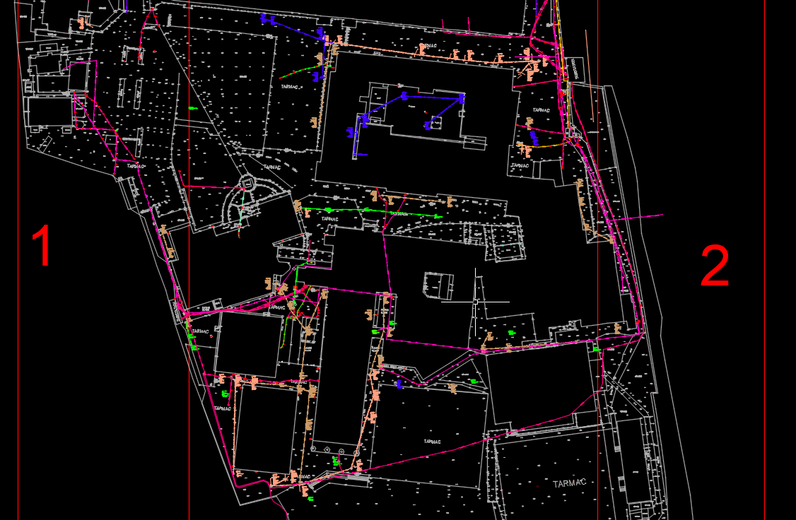
CAD/GIS Overlay Output — Professionally prepared drawings with all utility information overlaid onto a single base map, colour-coded by service type. We provide files in multiple formats including DWG, DXF, PDF, and Shapefile. Coordinate systems are aligned to Ordnance Survey National Grid (OSGB36).
Verification Recommendations — Professional advice identifying which services pose the highest risk and require field verification through electromagnetic location, GPR scanning, or trial pitting.
Comprehensive Written Report — A summary document detailing search scope, utility providers contacted, response status, known conflicts, and recommended next steps.
All deliverables are provided digitally via secure file transfer. We recommend updating searches if more than 12 months elapse before ground works commence.
Find out more about how we work… Call us on 01279 927033
TRUSTED BY












WHY WORK WITH US FOR YOUR UTILITY SEARCHES?
✔️ Thorough, methodical record requests — We contact all relevant statutory undertakers and maintain detailed logs to ensure comprehensive coverage.
✔️ Experienced in vetting utility returns — Our team reviews returned data for inconsistencies, outdated information, and obvious errors.
✔️ Seamless hand-off to survey services — We transition directly from desktop searches to GPR surveys or electromagnetic location without briefing a new contractor.
✔️ Transparent about limitations — We clearly communicate data gaps, non-responses, and areas requiring field verification.
✔️Aligned with our surveying and GPR teams — Your utility search informs our field detection strategy, creating an efficient, coordinated approach.
1. Project Intake & Site Definition — You provide the site boundary, location plan, and OS grid references. We confirm the search area extent and discuss any specific utilities of concern.
2. Search Request Submission — We contact all relevant utility providers including gas networks, water companies, electricity distributors, telecommunications providers, highway authorities, and private infrastructure owners. Requests are submitted through LSBUD, direct utility portals, and email.
3. Response Monitoring — Standard utility response times are 3-10 working days. We actively chase non-responding providers and document any failures to respond..
4. Data Quality Checking — We verify spatial accuracy, identify conflicts between different providers' data, flag shallow utilities crossing your site, and digitise paper-based records where necessary.
5. Report Delivery — You receive a complete package within 2-3 working days of receiving all utility responses.
6. Follow-Up Consultation — We provide advice on which utilities require field verification and can seamlessly transition to GPR surveys or electromagnetic location services.
THE SEARCH PROCESS EXPLAINED
Stage 1: Desktop Utility Search — Identify known services from utility records to establish baseline understanding.
Stage 2: Electromagnetic Location & GPR Survey — Our detection specialists use electromagnetic locators and ground-penetrating radar to verify recorded utilities and detect unmarked services.
Stage 3: Utility Mapping & Topographical Survey — Precise surveying of located utilities with measured depths, integrated into topographical surveys.
By offering the complete spectrum of utility investigation services, we eliminate coordination delays and provide a single point of accountability. Many clients choose our Utility Intelligence Package, which bundles desktop searches with field detection for comprehensive service identification.
INTEGRATION WITH OUR OTHER SERVICES
FAQs
-
Costs vary depending on site size and location. Expect £200-£800 for most residential or small commercial sites. Contact us for a tailored quote.
-
Most searches are completed within 5-10 working days from instruction, depending on the utility provider's response times.
-
A search obtains existing records from utility companies without visiting the site. A survey involves physically detecting and mapping utilities on-site with electromagnetic locators and GPR. Most projects benefit from both.
-
This is common. Utility records are frequently incomplete, particularly for older infrastructure, private services, and abandoned utilities. This is why field verification is recommended.
-
Our standard search covers statutory undertakers and major infrastructure owners. Private services are rarely recorded centrally and require field detection.
-
Desktop Utility Searches (Records Only)
(No site visit — data sourced from statutory utility providers)
Standard Desktop Utility Search includes records from all statutory utilities: gas, water, electricity, sewerage, and telecommunications.
Best for early-stage design and planning before excavation or field survey.
Core Utilities Search (Gas, Water, Power)
A focused package covering gas, potable water, and electricity only — ideal for smaller or low-risk projects.Extended Desktop Utility Search
Covers everything in the Standard Search plus drainage, street lighting, traffic signals, and fibre-optic networks for a fuller picture of underground infrastructure.
FreeView Overlay (Desktop Package)
Combines all available utility records into a single georeferenced CAD or PDF drawing, showing every network layer in a single view.Perfect for design coordination, feasibility studies, and project planning.
Desktop searches are record-based only — not verified on site. Absence of a record does not mean absence in reality. Accuracy and depth data vary depending on the provider.
-
Our utility search service aligns with industry best practices including PAS 128:2022 (desktop searches are Quality Level D), CDM Regulations 2015, and HSG47 guidance on avoiding danger from underground services.
-
Excavating without adequate utility information exposes your project to significant legal and safety risks. Under the Health and Safety at Work Act 1974, employers must take all reasonably practicable steps to protect workers. CDM Regulations 2015 require clients and principal contractors to identify underground services during the pre-construction phase.
Industry data suggests over 60,000 utility strikes occur annually in the UK. The average cost of a gas main strike ranges from £30,000-£100,000+ including emergency response, repairs, and site downtime. Average project delays from major strikes extend 2-6 weeks, with potential for criminal prosecution and unlimited fines for serious incidents.
A modest investment in utility searches provides both practical intelligence and legal protection, demonstrating due diligence in discharge of safety obligations.
-
Once you receive your report, review data confidence levels, depth information, and any conflicting data. Services marked "Unknown" or "Approximate" require field verification.
Low-Risk Sites — If your search reveals minimal utilities and all providers responded, proceed with vigilant excavation practices.
Medium-Risk Sites — Where utilities are present but reasonably documented, we recommend electromagnetic location to verify positions.
High-Risk Sites — Urban locations or projects near major infrastructure require comprehensive GPR and electromagnetic surveys. Trial pitting may be necessary at critical locations.
Use the CAD overlay to inform foundation design and drainage layouts. Early identification allows design modifications that avoid costly utility diversions, which typically require 8-16 weeks lead time and can cost £5,000-£50,000+.
If more than 12 months elapses between your search and ground works, request an updated search to capture recent changes.

LOCATIONS WE COVER
HERTFORDSHIRE
BEDFORDSHIRE
CAMBRIDGESHIRE
NORTHAMPTONSHIRE
LONDON
ESSEX
KENT
OXFORDSHIRE
BERKSHIRE
NORFOLK
SUFFOLK
LINCOLNSHIRE
RUTLAND
OUR SERVICES
SETTING OUT SURVEYS
MEASURED BUILDING SURVEYS
AS-BUILT SURVEYS
TOPOGRAPHICAL SURVEYS
SITE ENGINEERING
PILING SETTING OUT
DESKTOP UTILITY SEARCH
VOLUME ANALYSIS
UNDERGROUND UTILITY SURVEYS
3D LASER SCANNING SURVEY
GPR SURVEYS
DRONE SURVEYS
Request a Quote
Ready to request a quote for your Utility Search?
Fill out the form below, and you can expect to hear from us within 24 hours.
(If you do not receive a response within 24 hours (Mon-Fri) please email office@aknengineering.co.uk)





Book Your Utilities Search Today
Call us on
01279 927033

DESKTOP UTILITY SEARCHES — STATUTORY RECORDS & ASSET PLANS
AKN Engineering provides desktop utility searches for designers, civil engineers and main contractors across Hertfordshire, Essex, London, the South East and East Anglia. We request and collate statutory undertaker records and existing utility asset plans into a single reference pack, supplied on CAD — commonly used at planning and design stage and as the first step ahead of an on-site PAS 128 utility survey.
Constructionline Gold · SSIP Accredited · Achilles · Fully insured · All engineers PAYE
Also see: Underground Utility Surveys · GPR Surveys · Topographical Surveys