
DRONE SURVEYS
(UAV & AERIAL SURVEY SERVICES)
CALL US: 01279 927 033
RAPID, ACCURATE SITE DATA FROM ABOVE — DELIVERED IN CAD-READY FORMAT
When ground-based surveys are slow, restricted, or impractical, our drone survey service provides fast, high-accuracy aerial data across your entire site in a single mobilisation.
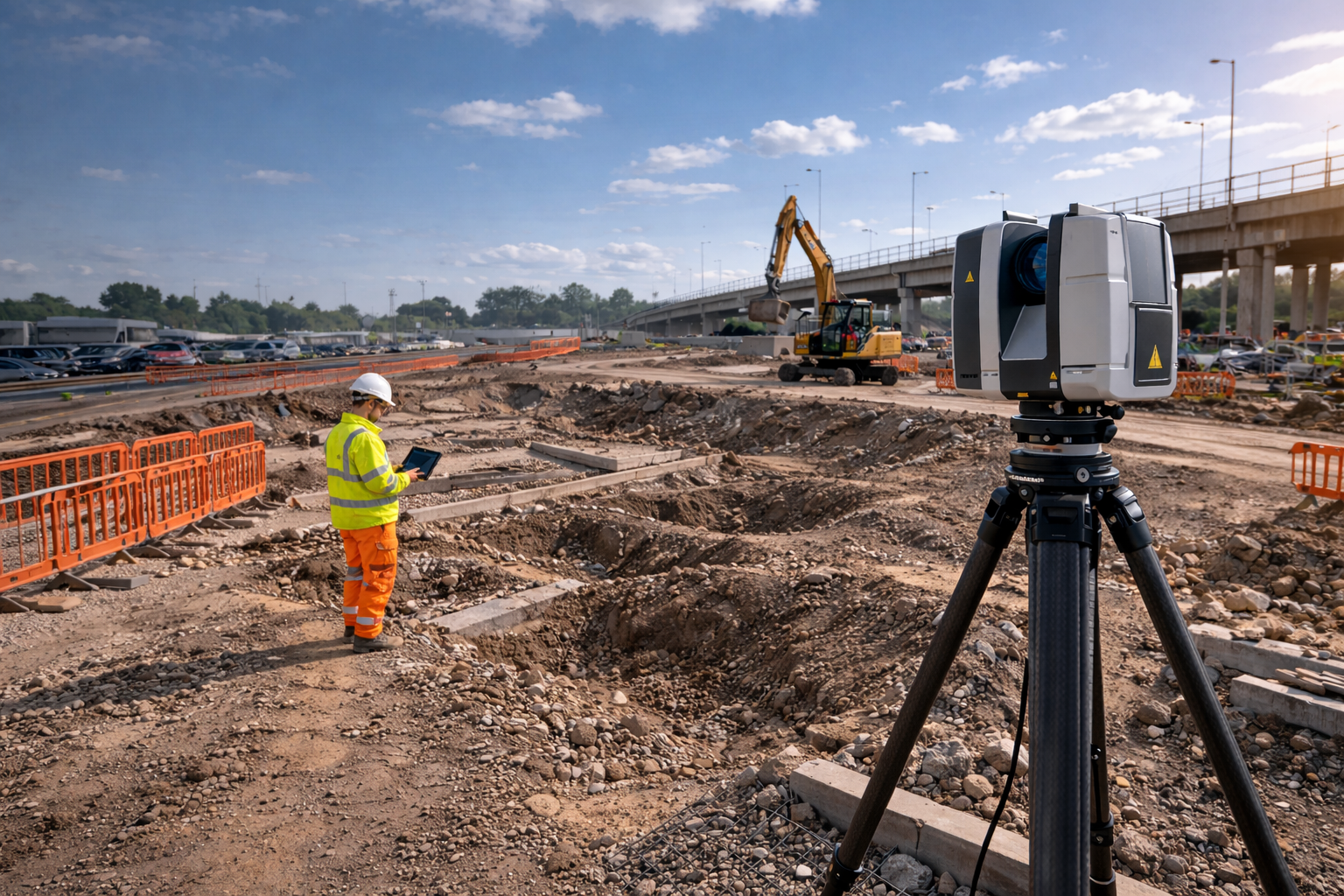
At AKN Engineering, we operate CAA-compliant UAV survey systems to capture topographic data, volumetric measurements, and aerial site surveys — giving project managers, developers, and design consultants the precise information they need to move forward with confidence.
A drone survey (also known as a UAV survey or aerial survey) uses an unmanned aerial vehicle equipped with high-resolution cameras and GPS/GNSS positioning to capture accurate topographic and spatial data across a site from above.
The data collected is processed into survey-grade outputs including topographic plans, digital terrain models (DTMs), orthomosaic maps, and volumetric calculations — all georeferenced and ready for use in CAD and GIS environments.
Drone surveys are used across construction, development, infrastructure, and land management sectors wherever fast, accurate, and wide-area site data is needed.
WHAT IS A DRONE SURVEY?
Our clients commission drone surveys when:
📍Pre-planning and feasibility — you need accurate topographic data before design begins
📍Volumetric calculations — cut and fill analysis, stockpile volumes, earthworks verification
📍Large or complex sites — where traditional ground survey would take significantly longer
📍Progress monitoring — regular aerial snapshots showing construction progress over time
📍Inaccessible terrain — steep embankments, watercourses, contaminated land, or live infrastructure
📍Pre-construction surveys — baseline data capture before groundworks commence
📍Planning applications — accurate site context plans and topographic information for submissions
WHEN DO YOU NEED A DRONE SURVEY?
Want to discuss a project? Call us on 01279 927033
Our drone survey outputs are fully CAD-integrated and formatted for your project workflow:
✅ Topographic survey plans — contours, spot levels, and features in DWG/DXF/PDF format
✅ Orthomosaic maps — georeferenced aerial photography for site context and planning
✅ Digital Terrain Models (DTM) — accurate surface models for design and earthworks
✅ Volumetric reports — cut/fill analysis and stockpile calculations
✅ Progress photography — time-stamped aerial imagery for project records
✅ GeoTIFF exports — compatible with GIS and CAD platforms
✅ Combined deliverable packages — drone data integrated with ground-based topographic survey where required
WHAT WE DELIVER
WHY CHOOSE A DRONE SURVEY?
Speed — a drone can survey a site in a fraction of the time required by a ground team, reducing mobilisation costs and programme delays.
Coverage — large land parcels, linear infrastructure routes, and complex sites can be captured in a single flight session.
Safety — inaccessible or hazardous areas such as embankments, live carriageways, and contaminated ground can be surveyed without placing engineers at risk.
Accuracy — modern UAV survey systems achieve centimetre-level accuracy using ground control points (GCPs) and RTK/PPK GPS positioning, meeting the requirements for construction-grade topographic data.
Consistency — repeat drone surveys over a project's lifetime provide directly comparable datasets, ideal for volume tracking and progress monitoring.
Find out more about how we work… Call us on 01279 927033
TRUSTED BY


COMBINING DRONE AND GROUND SURVEYS
For the most accurate and complete site dataset, we frequently combine drone surveys with ground-based topographic survey methods. This hybrid approach delivers:
✅ Aerial coverage for wide-area or complex terrain
✅ Ground-verified control points for maximum accuracy
✅ Feature capture at ground level where aerial resolution is insufficient (drainage, kerbs, utilities)
✅ A single integrated CAD deliverable combining both datasets
✅ Our team can advise on the right survey approach for your project during a free pre-survey consultation.
Call us on 01279 927033 to discuss your project
WHO WE WORK WITH
Our drone surveys support a wide range of construction and development professionals:
📍 Structural and civil engineers — requiring topographic data before design
📍 Planning consultants — needing accurate site context for planning applications
📍 Main contractors — tracking earthworks volumes and site progress
📍 Developers — carrying out pre-acquisition or feasibility assessments
📍 Quantity surveyors — verifying excavation and fill volumes
📍 Architects — requiring accurate site context for design work
📍 Local authorities — managing infrastructure assets and land
Areas Covered for Drone Surveys
AKN Engineering is based in Bishop’s Stortford, Hertfordshire, and provides drone surveys across the South East and East of England. We work regularly in Hertfordshire, Essex, North London, East London and Cambridgeshire, and cover the wider South East including Kent, Surrey, Suffolk, Norfolk and Bedfordshire.

HERTFORDSHIRE
BEDFORDSHIRE
CAMBRIDGESHIRE
NORTHAMPTONSHIRE
LONDON
ESSEX
KENT
OXFORDSHIRE
BERKSHIRE
NORFOLK
SUFFOLK
LINCOLNSHIRE
RUTLAND
WHY CHOOSE AKN ENGINEERING FOR DRONE SURVEYS
✔️ CAA-compliant operations — all flights conducted under current UK CAA drone regulations
✔️ Fully insured — public liability and professional indemnity coverage for all survey operations
✔️ Experienced engineering team — outputs checked and verified by qualified surveyors, not just pilots
✔️ CAD-ready deliverables — data processed and formatted for direct use in your design workflow
✔️ Combined survey capability — drone data integrated with ground survey, GPR, and utility mapping services
✔️ Fast mobilisation — typical attendance within 3–5 working days of instruction
✔️ Local knowledge — based in Bishop's Stortford, operating across Hertfordshire, Essex, Cambridgeshire, Suffolk, Norfolk, and the wider South East
We offer transparent, fixed-cost quotes for every project. Contact us for a tailored estimate — there's no obligation and no awkward conversation about budget.
Call us on 01279 927033 to discuss your project
FAQs
-
A drone survey uses a UAV (unmanned aerial vehicle) fitted with cameras and GPS positioning to capture accurate aerial data across a site. The data is processed into topographic plans, terrain models, orthomosaic maps, and volumetric reports for use in construction, planning, and design.
-
Using ground control points (GCPs) and RTK/PPK GPS positioning, modern UAV survey systems can achieve horizontal and vertical accuracy of ±20–30mm in favourable conditions — sufficient for construction-grade topographic data and volumetric calculations.
-
Both have their place. Drone surveys are well-suited to large sites, wide-area coverage, volumetric analysis, and repeat monitoring. Ground-based topographic surveys offer more detail at feature level — kerbs, drainage, utilities — and perform better in confined areas or heavy vegetation. Many projects benefit from a combined approach. We can advise on the right method for your site.
-
Site time depends on the size and complexity of the site. Many sites can be flown in a single session of 1–4 hours. Processing and delivery of CAD outputs typically takes 3–5 working days following the survey.
-
We operate across Hertfordshire, Essex, Cambridgeshire, Suffolk, Norfolk, Bedfordshire, Northamptonshire, London, and the wider South East.
-
Yes. Orthomosaic maps and topographic plans produced from drone surveys are routinely used to support planning applications, providing accurate site context, contour data, and boundary information.
-
Yes. We regularly combine aerial drone data with our ground-based topographic and underground utility surveys to produce a single integrated dataset. This is particularly useful for pre-construction packages where both surface and subsurface data are required.
-
All AKN Engineering drone operations are conducted in accordance with current UK Civil Aviation Authority (CAA) regulations. We hold the relevant permissions and insurance for commercial survey operations, including operations in controlled airspace where required.
Request a Quote
Ready to request a quote for a Drone survey?
Fill out the form below, and you can expect to hear from us within 24 hours.
(If you do not receive a response within 24 hours (Mon-Fri) please email office@aknengineering.co.uk)


Book Your Drone Survey today
Call us on
01279 927033
Our Services
Wondering what else we can help with?
Explore other services we offer by clicking the button below
