
GPR vs EML — Which Detection Method Is Right for Your Utility Survey?
GPR and EML detect different types of buried services — and neither is sufficient on its own for most UK construction sites. This guide explains what each method does, where each falls short, and why PAS 128 Type B specifies both in combination.

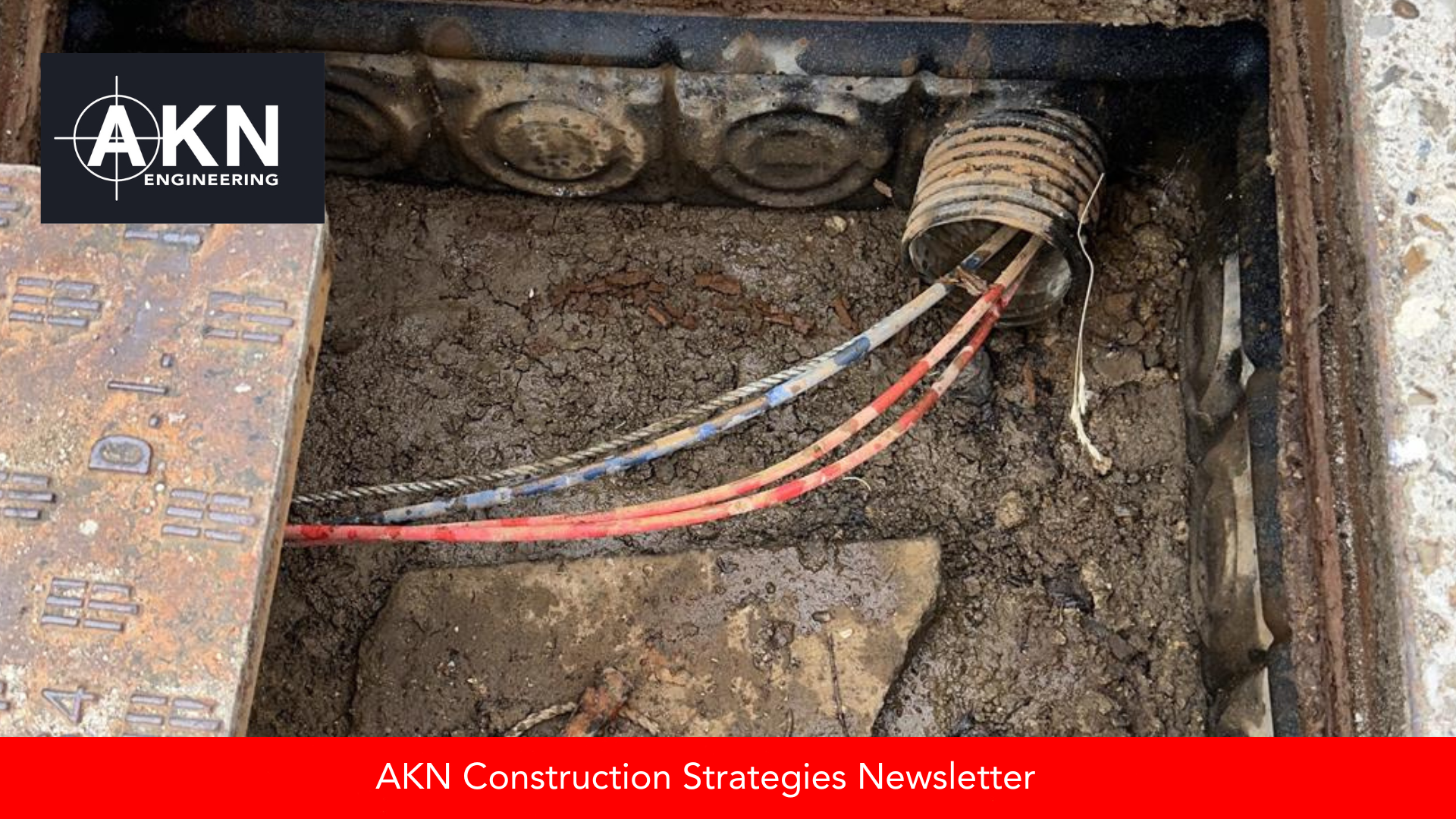
What Evidence Protects You After a Utility Strike on a UK Infrastructure Project?
Utility strikes create commercial and legal risk. We explain what documentation and verification protect contractors and how PAS 128 surveys support excavation defence on UK projects.

What Is a GPR Survey and How It Fits Into PAS 128 (UK Guide)
Most clients ask for a 'GPR survey' when what they actually need is PAS 128 detection. This guide explains what GPR can and can't do, how it fits into Type B investigations, and what a proper survey pack should include.

Who Signs the Permit to Dig — and What Should Be Verified First? (UK Guide)
The Permit to Dig process protects excavation works on UK civils projects. We explain who signs it, what must be verified and how to reduce underground service risk before breaking ground.

Who Is Responsible for Underground Utilities on a UK Civils Project?
Confusion around underground utility responsibility is a major cause of delay on UK civils projects. We explain who owns what and how early coordination protects programme and safety.

How Accurate Is a Total Station on UK Civils Projects?
Total stations can achieve millimetre accuracy — but only with verified control and proper setup. We explain what affects real-world survey precision on UK highway and civils projects.

How Main Contractors Use Site Engineering to Protect Programme on Highway Works
Programme delays on highway works usually start with assumptions about control and responsibility between packages. We explain how main contractors use site engineering to prevent avoidable delays and protect commercial performance on Section 278, Section 38 and civils framework schemes.
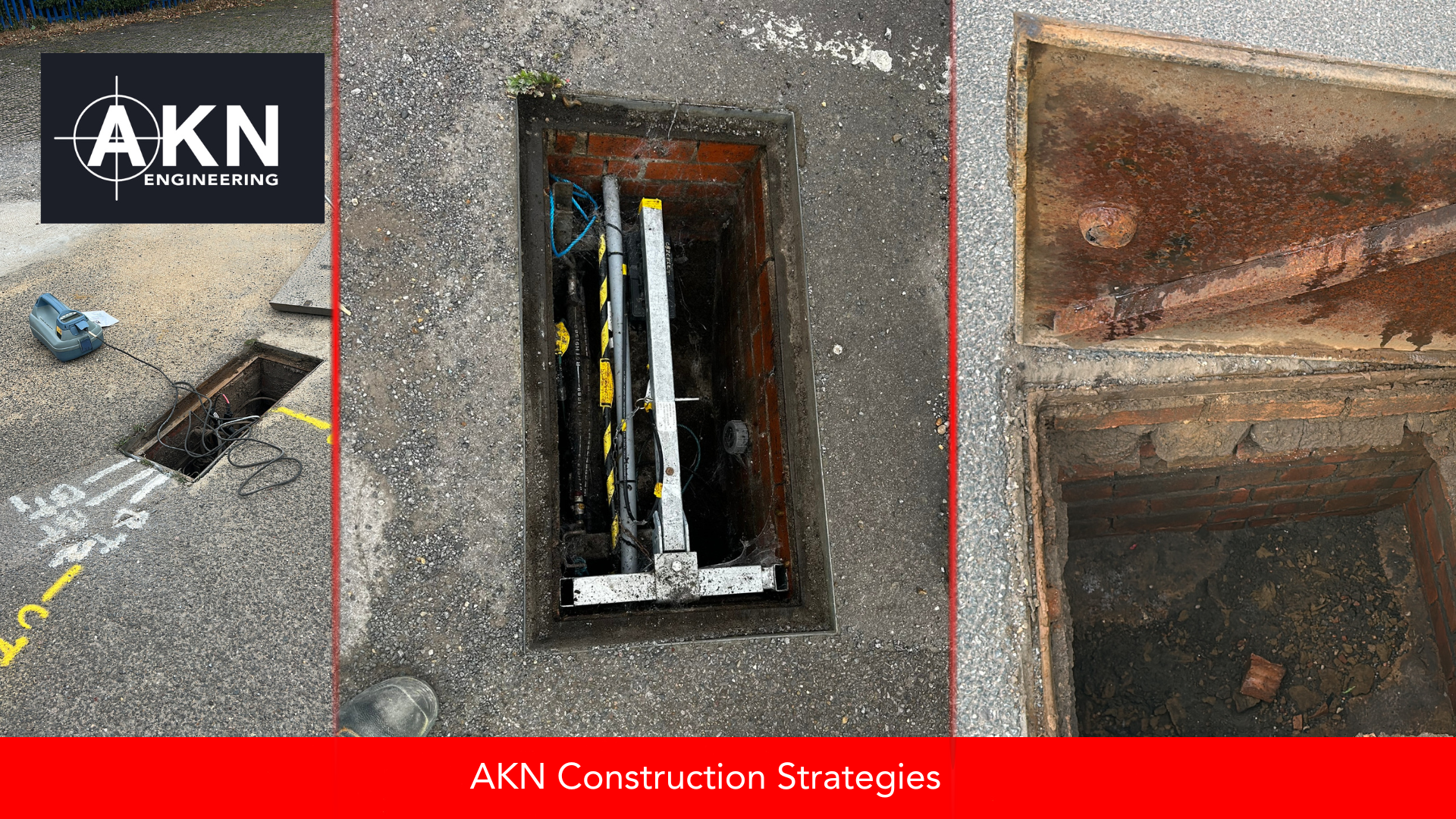
Do You Need a PAS 128 Utility Survey or Desktop Utility Search? (UK Guide)
Utility records searches and PAS 128 surveys are often confused, but they serve different purposes at different project stages. We explain what each delivers, how they impact design and construction, and when UK contractors should use each option for cost, safety, and compliance.

Site Engineer vs Surveyor in the UK – What’s the Difference and Why It Matters
Site Engineers, Setting Out Engineers and Surveyors are often treated as interchangeable, but on UK civils projects the differences matter for competence, documentation and delivery. This guide explains the roles clearly and why it matters for contractors, PMs, QSs and international engineers.
How Long Does a Full Utility Survey Typically Take – and When Should It Be Scheduled?
Utility surveys are one of the simplest ways to de-risk excavation, drainage or piling — but only if they’re scheduled early. In this guide, we break down how long a full PAS 128 utility survey really takes, what happens on-site vs during CAD processing, and when it should sit within your programme to avoid redesign, service strikes and stand-down costs.
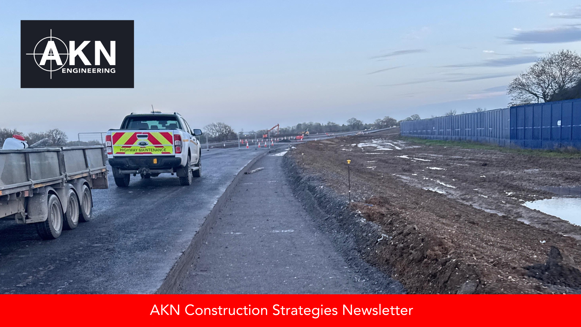
When Winter Utility Surveys Work (And When They Don't)
Winter utility surveys can be a smart planning move when sites are accessible and diversion lead times are critical. This guide explains when PAS 128 surveys work well in winter, when weather creates real limitations, and how contractors can plan ahead for early-2026 projects.

What Do PAS 128 Survey Types (M1, M2, B, C, D) Mean – and Which One Do You Need for Your Project?
PAS 128 survey types can be confusing if you’re not working with them day-to-day. This guide breaks down M1, M2, B, C and D in simple terms so project managers, engineers and contractors can choose the right survey level and manage underground utility risk confidently.

National Security Underground: The Utilities You’ll Never See on a Plan
Not everything beneath the surface is meant to be found. Some underground utilities are classified — hidden for national security reasons. Learn how utility surveyors identify the invisible networks that keep the UK running safely without ever appearing on a plan.

UK Coordinate Systems Explained: Why the Right Choice Matters for Survey Control
Using the wrong UK coordinate system can mean centimetre-level misalignments. Learn how to avoid costly errors with OSM15 vs OSM32.

How to Transfer DWG Plans to a Construction Site with Precision
Moving from CAD drawing to ground needs millimetre precision. Discover how AKN Engineering sets out DWG plans to keep your project on time and on spec.
Local Coordinates and GNSS: How to Align Them for Accurate Site Engineering
Learn how to align GNSS with local site coordinates and why calibration files are critical for highways and machine control projects.

What an As-Built Survey Actually Tells You
An as-built survey is more than a drawing – it’s proof of what’s been built. Here’s what it tells you, why it matters, and how it helps contractors and clients.

Choosing the Right Survey Partner: What to Ask Before You Break Ground
Before you break ground, are you sure what lies beneath? From PAS 128 standards to survey turnaround times, here’s what every PM should ask before hiring a utility surveyor.

How the Building Safety Act Affects Site Engineers and Surveyors (Even on Non-Residential Projects)
Think the Building Safety Act only applies to high-rise flats? Think again. Here's what site engineers, surveyors, and contractors need to know—and how to stay compliant on infrastructure and highways projects.

Topographical + Utility Surveys = Seamless Site Start
Design and build only work when you know what’s above and below ground. Discover how topo + utility surveys lead to smarter, safer project starts.


