What Are Utilities Surveys and Why Do They Matter on Construction Projects?
Before you even think about breaking ground, here’s a simple truth:
Ignoring what’s beneath the surface can cost you thousands
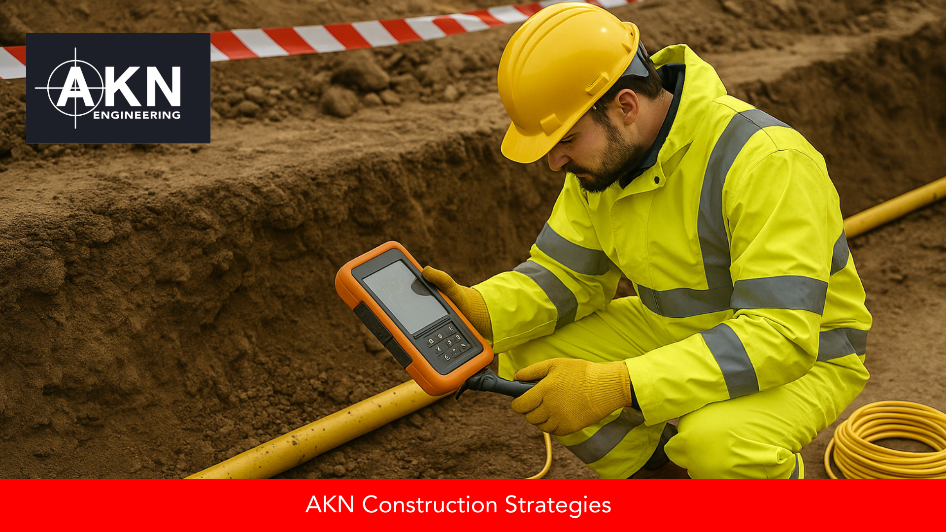
A utilities survey, sometimes called a utility mapping survey or underground utility detection, is a key part of safe and effective pre-construction planning. It helps identify, map, and mark underground services like gas, water, electricity, drainage, and telecommunications.
At AKN Engineering, based in Hertfordshire and working across East Anglia & London (Including Cambridgeshire, Essex, Norfolk, Suffolk, Northamptonshire, Leicestershire, Buckinghamshire and Kent), we support contractors and engineers on highways and infrastructure projects where accurate information is vital. In this post, we’ll explain what utility surveys involve, how they’re carried out, and why they play such an important role on construction sites of all sizes.
Launching our new Utilities Surveying service: AKN engineers now carry out PAS 128-compliant surveys across Cambridgeshire, Essex, Hertfordshire, and Suffolk to detect underground services safely before construction begins.
What is a Utilities Survey?
A utilities survey is a process used to detect and map underground services. It helps reduce the risk of hitting buried infrastructure during excavation, which could lead to injuries, costly delays, service disruptions, and legal issues.
These surveys are used on a wide range of projects—from new housing developments to major road schemes—particularly during pre-construction planning and groundworks stages. They’re also useful for design engineers and utility companies when deciding where to route new services.
Why Are Utilities Surveys Important?
Here’s why more contractors are making utilities surveys a non-negotiable part of the job:
Health and safety: Striking a gas main or high-voltage cable can be dangerous. A proper survey helps protect site workers and the public.
Project delays: Unplanned service strikes can bring work to a standstill, sometimes for weeks
Cost: Emergency repairs, fines, and compensation claims can quickly run into tens of thousands of pounds.
Planning accuracy: Knowing where existing services are means fewer design changes later.
In 2024, over 60,000 cable strikes were reported across the UK . Each one risked lives and added days or even weeks of delays.
This is especially important on highways projects, where there’s often limited room for rerouting services and delays have a big impact on public infrastructure and traffic.
How Do Utilities Surveys Work?
Utilities surveys use a combination of non-intrusive detection methods to locate underground services:
Ground Penetrating Radar (GPR)
This technology sends radar pulses into the ground and detects reflections from buried objects. GPR is great for locating non-metallic pipes (like plastic water pipes) and providing a 3D view of what’s below.
GPR is especially useful in congested urban areas or older infrastructure sites, where records may be unreliable or missing entirely.
Electromagnetic Locators (EML)
Often used in conjunction with signal transmitters, EML can trace the route of metal pipes and cables. It’s especially useful for detecting electric and telecoms cables.
Electromagnetic Locators are a fast, effective way to trace live power and comms lines — especially when combined with GPR for full coverage.
Visual Inspection and Record Searches
Site Engineers may also inspect utility covers and access chambers, or request utility records from service providers for cross-checking.
What is PAS 128?
In the UK, the standard for utilities surveys is PAS 128, developed by the British Standards Institution (BSI). It outlines best practices for survey accuracy, methodology, and reporting.
It breaks surveys into different levels—Type D (desktop records search only) through to Type A (excavation and verification)—so project teams can assess the level of confidence in the data provided.
Our deliverables typically include marked-up CAD files, colour-coded utility drawings, and a summary report aligned with PAS 128 standards – giving your design and ground teams full visibility.
Learn more about PAS 128 here.
Who Should Use a Utility Survey?
If you’re involved in:
Road widening or resurfacing
Housing development groundwork
Building extensions or new build projects
Site infrastructure installation
…then a utility mapping survey is a smart investment. It can help prevent costly mistakes and keep your project running smoothly from day one.
At AKN Engineering, we’re proud to bring this new service into our portfolio to complement our established work in land surveying, setting out, and site engineering.
Find out more about our Utilities Surveying service here.
Related Reading
To explore more about our approach to precision and planning on construction projects, check out these helpful reads from our blog:
Frequently Asked Questions
How long does a utility survey take?
It depends on the size and complexity of the site. A standard survey for a small site might take a day, while larger infrastructure projects can require multiple days.
Do I still need a survey if I have records from utility providers?
Yes. Utility records are often outdated or inaccurate. A physical survey verifies and updates what’s there, reducing risk.
A utilities survey might not be the most exciting part of a construction project, but it’s one of the most important.
Whether you're breaking ground on a housing estate or delivering a new section of highway, the data uncovered in a utilities survey helps everyone stay safer, work faster, and build smarter.
For more insights into land surveying and setting out in construction, and to see how our new utilities service can help you build smarter from day one, visit our website. We’re here to support your projects with accurate data and dedicated service.
For more insights into land and engineering surveys, visit our resources page.