
MONITORING SURVEYS
STRUCTURAL & DEFORMATION MONITORING
For Live Construction & Infrastructure Projects
Accurate monitoring is essential when you're working near live assets, sensitive structures or high-risk ground conditions. At AKN Engineering, we deliver precision monitoring surveys for highways, civils, earthworks, piling, bridge works and large-scale construction projects — giving main contractors the data they need to manage risk, protect programme and meet compliance requirements.
Understanding movement, deformation and settlement over time allows you to identify early warning signs before they become costly variations, safety incidents or delays. Under UK HSE regulations and CDM 2015, duty-holders must assess and control impact on adjacent structures and assets. In many NEC and Highways England frameworks, monitoring is now a mandatory risk-mitigation measure, not an optional extra.
WHAT IS STRUCTURAL MONITORING IN CONSTRUCTION?
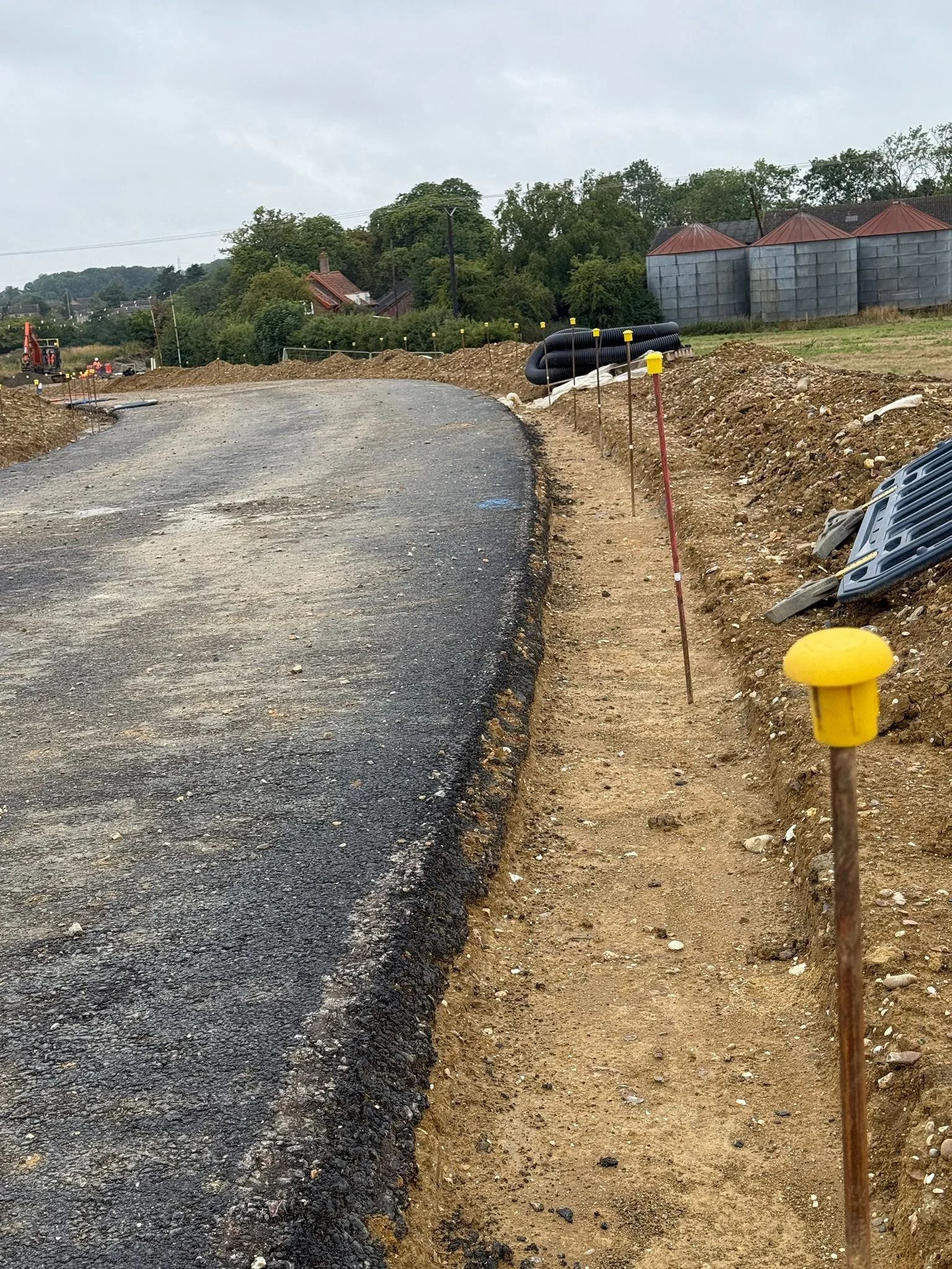
Structural monitoring is the process of measuring movement, settlement, rotation or deformation in buildings, structures and ground during construction activities. It provides accurate, repeatable data showing how an asset behaves when influenced by nearby excavation, piling, loading, traffic, vibration or changes in ground conditions. Monitoring points such as prisms, targets, sensors or gauges are installed on key structural elements and observed at agreed intervals to detect even the smallest changes.
For contractors and duty-holders, structural monitoring acts as an early-warning system. If a structure begins to move outside acceptable tolerances, alerts allow the project team to intervene before issues escalate into safety risks, damage, delays or claims. The data also creates an evidential record proving compliance, validating design assumptions and demonstrating that works have not adversely affected neighbouring assets.
Want to discuss a project? Call us on 01279 927033
A Monitoring should be one of your first considerations when planning works near existing assets or sensitive ground:
Pre-Excavation & Piling Works — Essential before deep excavations or piling within the influence distance of existing structures, highways or utilities.
Bridge Deck & Highway Works — Monitor embankments, abutments, deck movements and approach roads during construction phases.
Adjacent to Rail, Highways or Heritage Assets — Mandatory where works could affect Network Rail, Highways England or protected structures.
Ground Stabilisation & Basement Projects — Track settlement, heave and lateral movement during sheet piling, underpinning or basement construction.
Design & Build Contracts — Provide evidential proof of no damage for contractual compliance and warranty requirements.
Stakeholder Assurance — Demonstrate compliance to clients, local authorities, asset owners, insurers and neighbouring residents.
WHEN DO YOU NEED A MONITORING SURVEY?
Want to discuss a project? Call us on 01279 927033
WHAT WE DELIVER
A comprehensive monitoring survey provides the data and evidence needed to manage risk, prove compliance and protect your project:
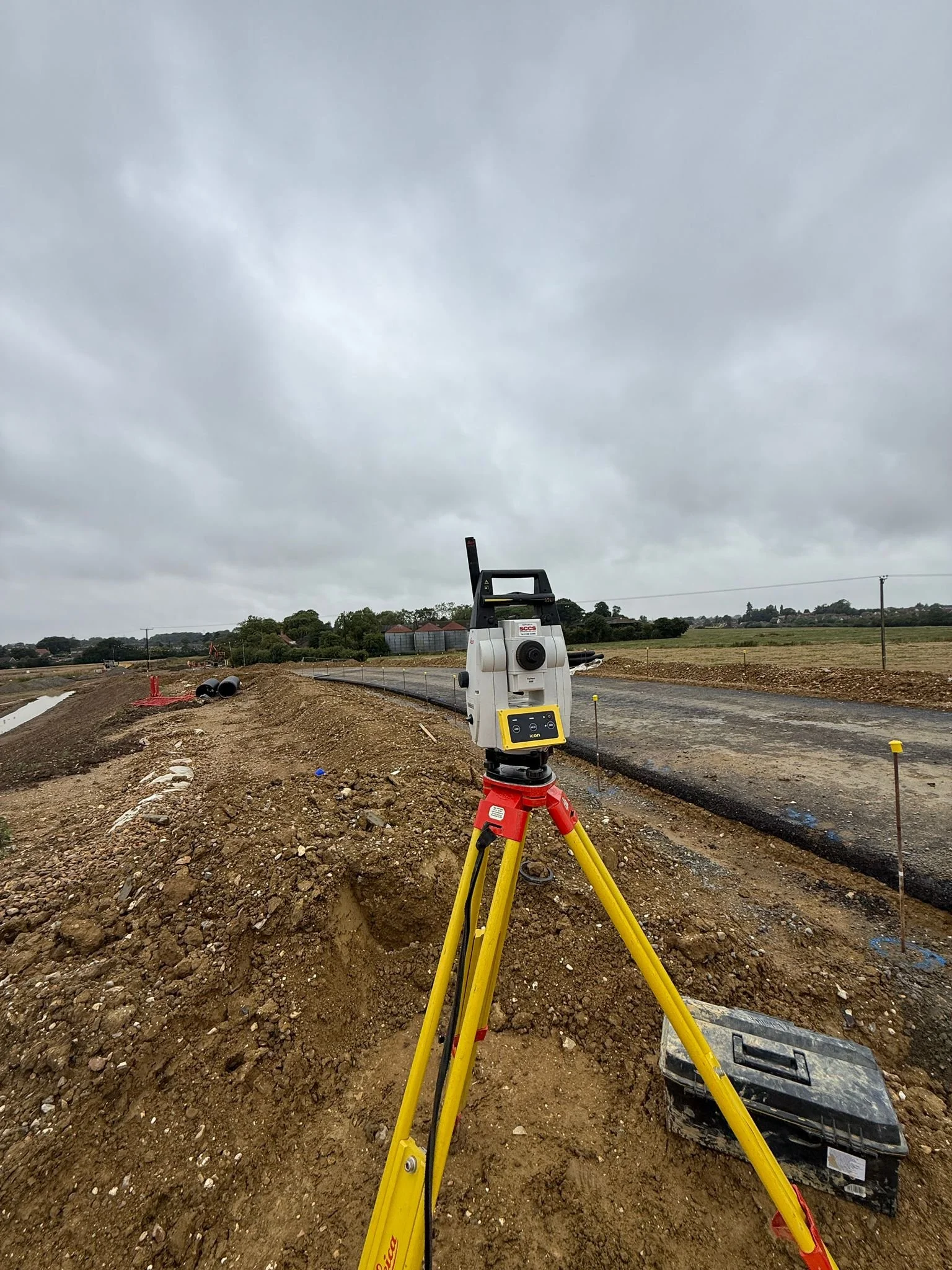
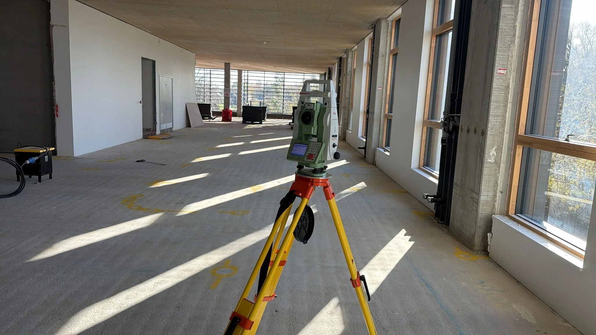
Baseline & Control Establishment — Pre-construction surveys establish baseline conditions, control networks and initial readings before works commence.
Automated or Manual Data Acquisition — Continuous or periodic monitoring using total stations, prisms, GNSS sensors, tilt meters, crack gauges or inclinometers depending on risk profile and programme.
Live Data Dashboards — Cloud-based monitoring platforms with real-time alert thresholds, audit trail history and visual trend analysis—not just raw numbers.
Engineer-Interpreted Reporting — Weekly summaries, threshold breach alerts, trend analysis and professional commentary from qualified engineers with site experience.
CAD/PDF Outputs — Coordinate lists, movement vectors, time-series graphs and visual overlays compatible with your project documentation systems.
Completion & Handover Pack — Full dataset archive, final monitoring report and evidence pack for O&M files, safety files, warranty documentation and QA records.
All data is provided digitally via secure cloud platforms or file transfer. Monitoring durations are flexible and can be extended or reduced based on observed performance and risk assessment.
Find out more about how we work… Call us on 01279 927033
OUR CLIENTS


WHY WORK WITH US FOR MONITORING SURVEYS?
✔️ Highways & Infrastructure Specialists — We're not general surveyors. We understand civils, highways, rail and infrastructure projects inside out.
✔️ Engineer-Led Delivery — Our monitoring data is analysed and reported by qualified engineers with real construction site experience—not just technicians collecting readings.
✔️ Fast Mobilisation — We respond quickly to install monitoring systems when your programme demands it, usually within 24–48 hours for urgent projects.
✔️ Live Data & Alert Systems — Cloud-based dashboards with configurable alert thresholds, automated notifications and full audit trail visibility.
✔️ Fully PAYE Qualified Team — No anonymous subcontract labour. You get our experienced, qualified engineers and surveyors on your site.
✔️ Seamless Integration with Other Services — Monitoring works alongside our setting out, topographic surveys and utility detection—single supplier, reduced admin, better coordination.
Scope & Methodology We define monitoring points, frequency, equipment type, alert thresholds and deliverable formats in collaboration with your team and design consultants.
Control & Installation Establish robust control networks, install monitoring targets (prisms, sensors, markers), verify stability and set initial baseline readings.
Baseline Survey Pre-construction surveys capture existing conditions before works commence—creating the datum for all future comparisons.
Data Acquisition Manual or automated readings depending on risk profile, programme requirements and site access constraints. Frequency ranges from continuous live monitoring to weekly or monthly surveys.
Alerts & Analysis Automated threshold breach alerts notify stakeholders immediately if movement exceeds pre-agreed tolerances. Engineers analyse trends and provide professional commentary.
Reporting & Handover Regular progress reports (weekly/monthly), final completion report and full data archive for project records, O&M files and warranty documentation.
THE MONITORING PROCESS EXPLAINED
Stage 1: Topographical Survey — Initial site surveys establish control and identify existing features before monitoring installation.
Stage 2: Utility Detection & Setting Out — Our survey teams locate utilities and set out works, coordinating monitoring point positions to avoid clashes.
Stage 3: Monitoring Installation & Baseline — Monitoring targets installed and baseline readings established before construction commences.
Stage 4: Construction Phase Monitoring — Continuous or periodic monitoring throughout the works, with alerts and reporting to manage risk.
Stage 5: As-Built Survey & Handover — Final as-built surveys confirm constructed conditions and monitoring data archives prove compliance.
By offering the complete spectrum of surveying and monitoring services, we eliminate coordination delays and provide a single point of accountability. Many clients choose our Site Engineering Package, which bundles monitoring with topographical surveys, setting out and as-built documentation.
INTEGRATION WITH OUR OTHER SERVICES
Structural & Deformation Monitoring ⤵
Automated or manual measurement of horizontal and vertical movement using total stations, prisms, GNSS sensors, tilt meters or crack gauges. Suitable for bridges, retaining walls, façades, earthworks slopes and live highways assets.
Geotechnical Monitoring ⤵
Monitoring settlement, heave, groundwater or lateral movement in relation to deep excavations, sheet piling, basement works and embankments. Includes inclinometers, piezometers and settlement plates.
Remote / Live Data Monitoring ⤵
Cloud-based dashboards with alert thresholds, audit trail history and analysed reports—integrated with project management systems or client portals.
TYPES OF MONITORING SURVEY WE PROVIDE
Want to discuss a project? Call us on 01279 927033
FAQs
-
Usually within 24–48 hours for urgent projects, or 3–5 working days for standard bookings depending on equipment availability and site access.
-
We use Leica robotic total stations, GNSS receivers, automated monitoring platforms, tilt meters, crack gauges and inclinometers—all maintained and regularly calibrated for precision
-
This depends on risk category and construction activity. Readings can range from continuous live monitoring with instant alerts to weekly or monthly manual surveys.
-
Yes. Most systems now use remote GSM or cloud-based dashboards for live reporting with automated alert thresholds and email notifications.
-
Under HSE law and CDM Regulations 2015, the contractor must assess, control and evidence impact on adjacent structures. Monitoring provides the evidential record to demonstrate compliance.
-
Yes, it provides an evidential record to support claims defence, handover documentation, warranties and insurance requirements. Baseline and ongoing readings demonstrate actual versus predicted performance.
-
Our engineers assess conditions, notify stakeholders immediately, and provide professional recommendations—keeping works compliant, safe and on track.
-
Yes. We work nationwide for large or long-term infrastructure projects. Get in touch to discuss your location.

LOCATIONS WE COVER
HERTFORDSHIRE
BEDFORDSHIRE
CAMBRIDGESHIRE
NORTHAMPTONSHIRE
LONDON
ESSEX
KENT
OXFORDSHIRE
BERKSHIRE
NORFOLK
SUFFOLK
LINCOLNSHIRE
RUTLAND
✔️ Unmonitored construction near existing assets can lead to:
Project delays of several weeks when structural damage occurs
Repair costs exceeding £50,000+ for adjacent asset damage
Claims, compensation events and contractual disputes
Safety incidents affecting workers, public or neighbouring properties
Programme disruption and unplanned temporary works requirements
Prosecution under HSE regulations or CDM 2015 for failure to manage risk
Our monitoring prevents these problems.
Accurate tracking ensures structural safety, proves compliance, protects adjacent assets and provides the evidential records you need for contract administration, NEC compensation events, design validation and handover.
Built-In Risk Management and Compliance
We interpret complex structural behaviour, adapt monitoring strategies to emerging risks, and coordinate seamlessly with construction teams—keeping every stakeholder informed and your project protected from claim exposure.
WHY MONITORING ACCURACY MATTERS

Want to discuss a project? Call us on 01279 927033


OTHER WAYS WE CAN HELP YOU
SITE ENGINEERING
Site engineering services play a critical role in the construction process, providing expertise and support to ensure the successful execution of a project. These services encompass a wide range of activities, including site investigation, surveying, and topographical mapping. Site engineers work closely with the design team and construction crew to establish the necessary groundwork, determine the optimal layout, and oversee the implementation of plans on-site.
TOPOGRAPHICAL SURVEYS
Topographical surveys are detailed assessments of the natural and man-made features on a specific piece of land. These surveys provide crucial information about the elevation, contours, and physical characteristics of the site, including buildings, trees, bodies of water, and other relevant elements. By conducting topographical surveys, engineers and planners can gain a comprehensive understanding of the terrain, which is essential for making informed decisions during the design and construction phases of a project.
SETTING OUT
Setting out is a vital process in construction that involves marking the precise locations and dimensions of structures, roads, or other elements on a construction site. It ensures that the project is executed accurately and in accordance with the design plans. Surveyors and engineers use various tools and techniques to establish reference points, levels, and alignments, allowing construction teams to follow precise measurements and positioning during the building phase.
AS-BUILT SURVEYS
As-built surveys are conducted typically at the completion of a construction project to document the actual constructed conditions of the site and its improvements. These surveys serve as a comparison to the original design plans and specifications provided by the engineer during the planning phase. By conducting as-built surveys, engineers can ensure that the constructed elements align with the approved design and meet all required standards and regulations.
MACHINE CONTROL
Machine control for earth moving involves the creation of precise digital models and plans, which are then translated into real-time instructions for construction equipment. Through the integration of advanced technologies such as GPS, sensors, and software interfaces, these machines are guided to execute excavation and grading tasks with exceptional accuracy and efficiency, resulting in reduced material waste, optimised project timelines, and enhanced overall productivity in earth-moving operations.
The main goal of volume calculation is to find out a volume of material that was mined or heaped up in predefined area and to verify if the volume corresponds to the expected value stated in project documentation. The volume is determined by a difference of topographies from two survey phases or by a difference between the survey and the project documentation.
MACHINE CONTROL
Request a Quote
Ready to request a quote for your Monitoring Survey?
Fill out the form below, and you can expect to hear from us within 24 hours.
(If you do not receive a response within 24 hours (Mon-Fri) please email office@aknengineering.co.uk)
TALK TO US
Experience the difference of working with industry experts who understand risk, compliance and construction programme demands.
If you would like to request a quote, discuss a project or have any other enquiries about Monitoring Surveys, Setting Out or Site Engineering, click the link button to get in touch.
